Description:
To assist with the accuracy and credibility of audits produced with Insite, GPS coordinate data can be recorded against images that are uploaded to or captured via the app. This article describes the processes for viewing the GPS coordinates when this data is available.
Notes:
- By default, GPS data is recorded against images uploaded to and taken within Insite, however, in some cases, the GPS coordinates may not be captured and so you will not have the option to view them.
Contents:
This article covers:
Guide:
1. Viewing the coordinate on a map
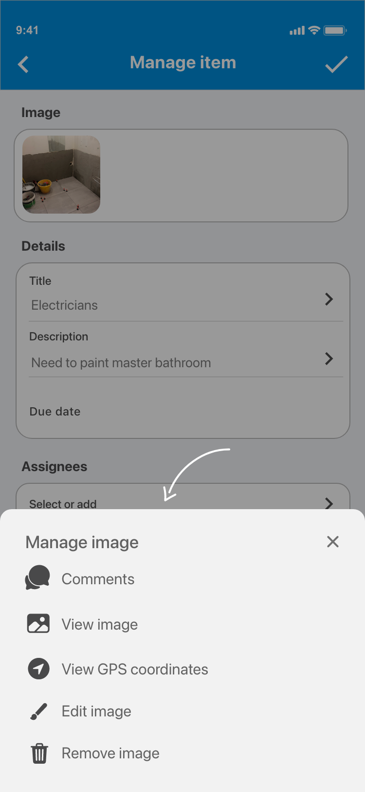
1.1. Open up the item that you would like to view the image GPS coordinates for.

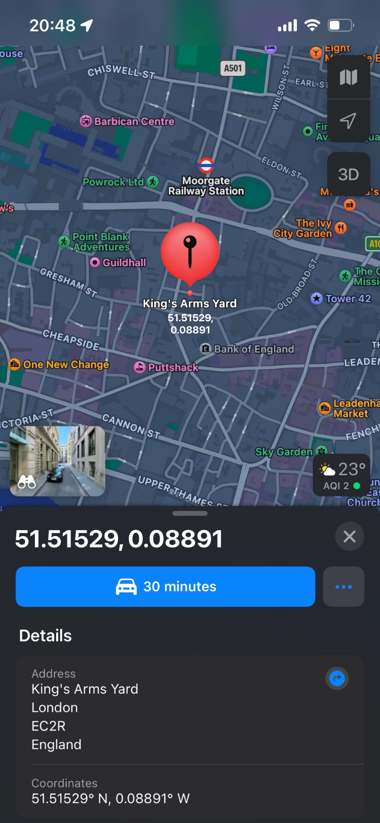
1.2. Tap the photo which you would like to view the image GPS coordinates for and choose View GPS coordinates from the Manage image popup. The coordinates will be presented either via the device's map app or via Google Maps.
2. Viewing the latitude and longitude of the coordinates
2.1. Open up the item that you would like to view the image GPS coordinates for.
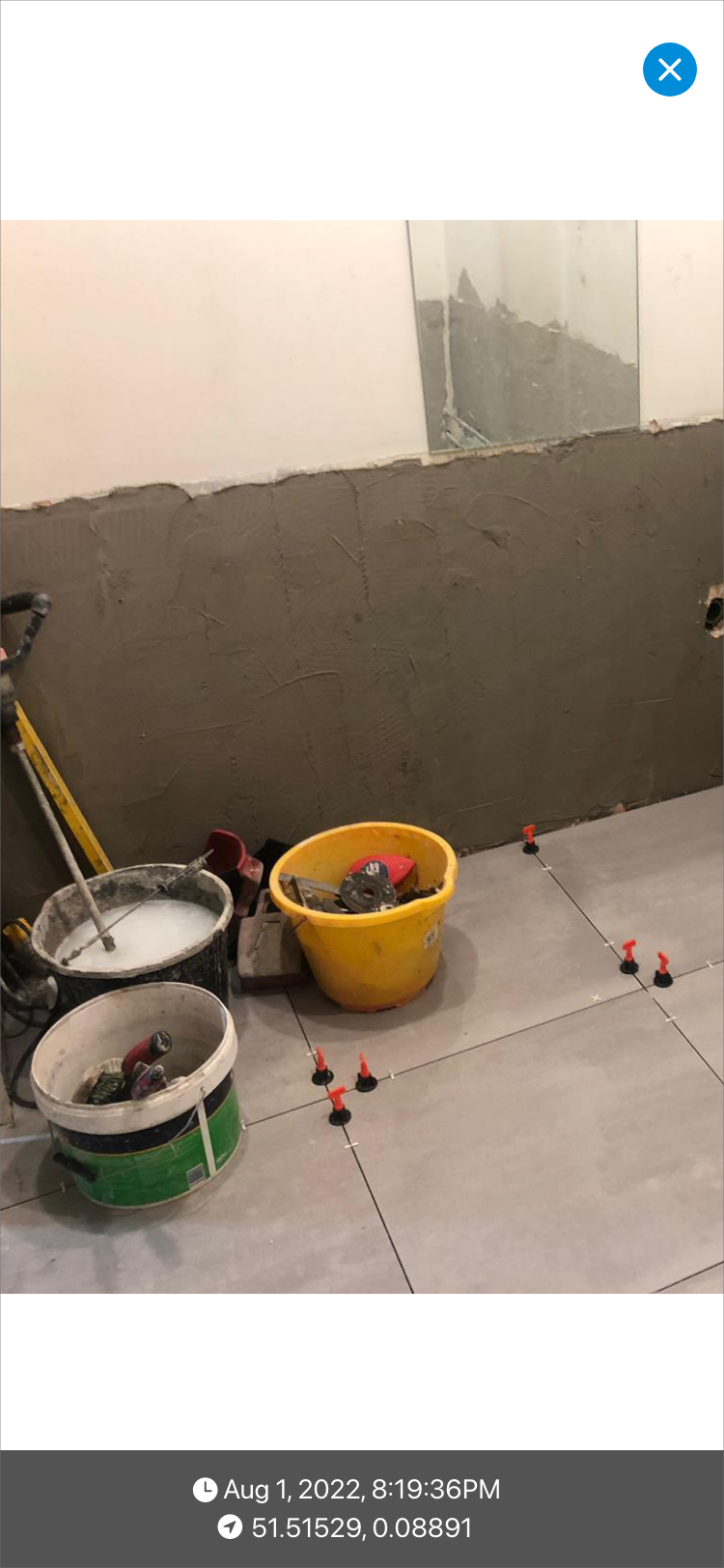
2.2. Tap the photo which you would like to view the image GPS coordinates for and choose View image from the Manage image popup. If available, the coordinates will be displayed with the format "latitude, longitude" at the bottom of the image.
Comments
0 comments
Please sign in to leave a comment.